
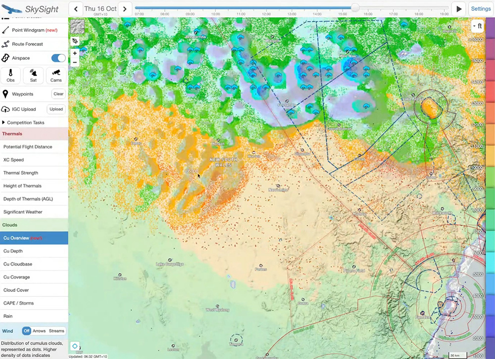
Skysight CU Overview showing the forecast development of cumulus in the task area.
Organised by the Rockettes, two-time Club Class Australian champion, Sophie Curio, gave a webinar about Weather Planning and Flight Preparation. In the webinar she described the planning process she goes through, with tips and advice covering:
1. How I decide whether to go flying
2. Where to fly and which task to set
3. In-flight strategies for deciding which path in the sky to take
4. Making the most of post flight analysis tools
Sophie began by showing how she uses Skysight for weather planning. Skysight is available to GAus members in a cut down version. You can access it by logging into your Justgo account, then menu, All My GFA Services, GFA Met Access.
How I decide whether to go flying
The first thing Sophie looks at is the Potential Flight Distance, available in the application’s full version. If the cross country potential looks promising, the next item she checks is a new feature – Point Windgram. This Skysight feature gives a very detailed snapshot of the wind and thermal strength, precipitation and cloud cover at all levels. See image. Sophie said, ‘This is a really neat way to get an overview of what is going on.’
Having decided that she will go flying, she next selects another new option, Cu Overview. See image above. Dots indicate cumulus, and their colour indicates their forecast height. By clicking through the time periods, a good overview can be gained of probable cu formation. She assesses the length of the usable soaring day – for example, five hours – and uses that as a parameter for setting the task.
Moving on to the Route Forecast tool, by clicking on the start location, a list of suggested tasks is given with a range of achievability. The ones coloured green should definitely be achievable. The tasks coloured light red are for tasks set from first thermal to last thermal. If one of the preset tasks is not ideal, then users can set their own tasks using click and drag, selecting the start and finish time and so on.
Another interesting feature when setting your own task and route is the black line that appears fairly close alongside the route you have chosen This line shows where Skysight calculates the best air will be, which may not correspond exactly to the selected route.
After deciding on a task Sophie usually uses the IGC Upload function to export a .cup file to Weglide. If you declare your flight on Weglide, you will receive extra points if you actually achieve it. She also downloads it to her flight navigation device – LX or Oudie.
Skysight Point Windgram. This overview of the weather for a location displays information such as wind, cloud, thermal strength and more.
Convergences
Sophie recommends checking for convergences using the dedicated Convergence tool. Looking at the wind direction and the areas of red and orange on Skysight, it is possible to see where air coming from different directions is forecast to meet, forming convergence lift. Where good convergence lines are forecast, she will always set her task to fly along them. If you are able to use convergences, they are great fun to fly.
Of course, she also looks at the wind direction and strength along the route, aiming to set up the final leg coming home with a tailwind.
Convergence forecast in Skysight.
OBS SAT CAMS
The last three items Sophie checks are the satellite view, web cams and local observations. Before heading out to launch, she always checks the satellite view, which is a near real time view of the sky, and compares it with the forecast. If the forecast is different from the sat view, the day may not be developing as expected. The sat view gives a picture over a larger area than looking up at the sky – what is often referred to as ‘forecasting by looking out the window’. In particular, she checks whether the first forecast cu are popping as expected, and if there is more mid-level or high cloud than forecast.
She also uses the OBS tool to check the actual conditions at stations in the region and along the route to see if they correspond to the forecast. Checking the webcam views from stations in the task area is advisable as well.
Pilots regularly use many other websites and information services to get a complete picture of the soaring day. Starting with the Bureau of Meteorology Aviation weather service, forecast and satellite images, XCSkies and numerous other resources are available as well.
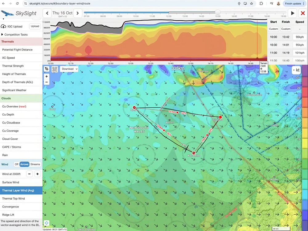
Task set using the Route Forecast tool.
In-flight Strategies
Next, Sophie describes how, once she is flying, she decides on her actual route for the day. She said, ‘Task setting is a high level job, but when you are in the glider you have to make the decision, do I go left or right or straight?’
In the webinar she shows some images of the sky from the cockpit and looks at reasons to deviate course. Cloud streets or very good looking clouds and visible convergences off route would cause her to deviate course. Conversely, bad weather such as showers would also cause a change of course.
Thermal Sources
Along route, she will also deviate to fly to good thermal sources such as dark paddocks, large buildings and towns. She recounted that during her early flying days in the UK, where the thermal ceilings are typically much lower than in Australia, she would spend most of the time looking at the ground. Later on when flying in Australia, she found herself looking more at the clouds and realised she was missing thermals as a result.
Now she pays attention to both the terrain and the skyscape along her route. Though she landed out many times in the early days in the UK, she credits this with a great improvement in her ability to spot thermal sources low down – an essential skill for glider pilots.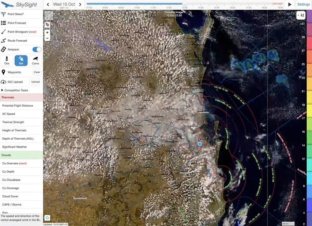
Satellite view from Skysight.
Ridge Lines
She pays particular attention to ridges and hills and makes sure to position herself on top or upwind as she traverses them – not downwind where sink is more likely.
How far to Deviate?
When answering this question, she notes that on cumulus days, deviation of 25 degrees is normal, while on blue days, deviation is usually less. However, if you are low, then any amount deviation may be necessary to find a climb.
When to Abandon the Task?
Sophie said that she has never abandoned a competition task. But she does call it a day outside comps for a variety of reasons including bad or poor conditions and a prudent desire to get home rather than risk a landout.
View of a cloud street showing the line Spohie would take to stay under the best clouds.
Post Analysis Tools
She recommends using the statistics available on flights uploaded to Weglide where parameters including wind, climb rate, angle of bank can all be examined. It is possible to link your Skysight and Weglide accounts, and replay your flight in Skysight. This allows you to see your flight overlaid on both the forecast and the satellite images for the day. In Weglide, you can also overlay traces from pilots who flew tasks similar to yours, to see how your decision making compares to theirs.
Sophie’s webinar is an excellent way to familiarise new cross country pilots with doing their own weather forecasting and setting tasks.
You can view the webinar at tinyurl.com/rockettes-weather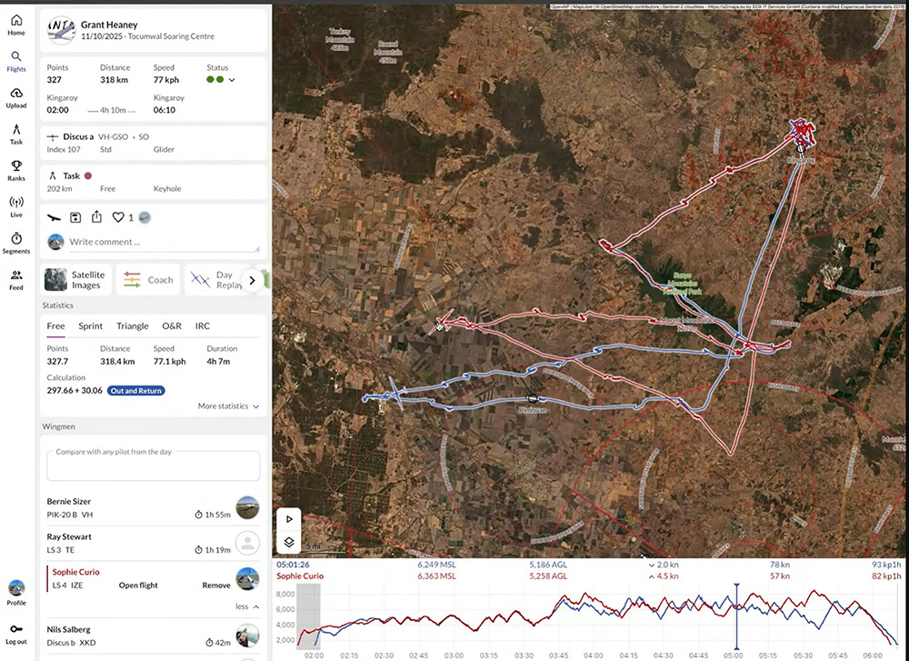
Overlaid traces of two gliders that flew the same task in Weglide.


